Washington DC (US)
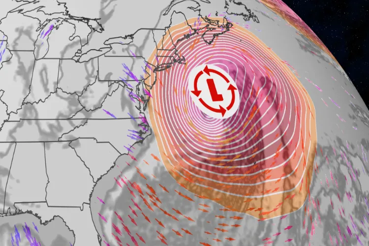
A powerful winter storm is expected to develop off the US East Coast this weekend and rapidly intensify into a bomb cyclone, potentially impacting parts of the Eastern Seaboard, CNN reported.
According to the US boradcaster CNN, forecast models as of Wednesday indicate that the storm will form off the coast of the Carolinas early Saturday and strengthen rapidly enough to meet the criteria for a bomb cyclone. However, uncertainty remains over its exact track and intensity, which will determine which regions experience snow, strong winds or coastal impacts.
Meteorologists caution that even a shift of 100 to 200 miles in the storm's path could mean the difference between a major snowstorm for large East Coast cities or merely a cold and breezy weekend.
CNN reported that parts of the Carolinas and southern Virginia currently have the highest likelihood of experiencing significant snowfall and strong winds, regardless of the storm's eventual track. Forecast confidence decreases further north, though southeastern New England has a higher chance of wind-driven snow.
The CNN presented three scenarios regarding the upcoming bomb cyclone.
One scenario, considered the most likely by recent computer models, suggests the storm will track close to the coast, bringing snow and strong winds to parts of the Southeast and coastal areas of the mid-Atlantic and New England, while largely sparing major cities along the Northeast's Interstate-95 corridor, including Washington DC and New York City.
Coastal flooding and beach erosion in this case would be limited to areas along the coastline from Cape Hatteras, North Carolina, to Cape Cod, Massachusetts.
A second scenario, though less favoured, could see the storm hugging the coast more closely, triggering heavy snow and strong winds from the eastern Carolinas through the I-95 corridor. CNN noted that such a track would compound impacts from last weekend's storm, as several communities are still recovering from power outages and snow amid record-cold temperatures.
A third and least likely scenario involves the storm moving out to sea shortly after forming, keeping its strongest winds and snowfall offshore and sparing even the Carolinas from major impacts.
ALSO READ: I received my wages for hard work of decades: Ghafruddin on Padma Shri
CNN further reported that the upcoming storm will differ significantly from the previous widespread winter system that affected much of the eastern United States. While more intense and wind-driven, the storm is expected to have a smaller footprint. A wintry mix of freezing rain and sleet is unlikely due to cold air ahead of the system, though blizzard conditions and damaging coastal waves remain possible.
The media outlet advised residents from the Carolinas to the Northeast to closely monitor updated forecasts as the weekend approaches, noting that the likelihood of a significant storm is increasing.
